Invierno
Verano
El tiempo
Webcams
Alojamientos
Excursiones
Historial de búsqueda
Sugerencias de búsqueda
No se han encontrado resultados
Buscar en
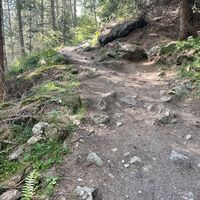
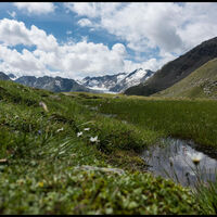
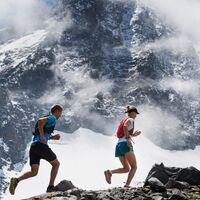
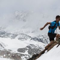
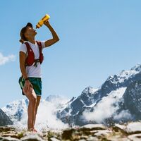
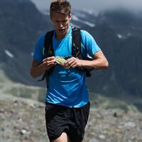
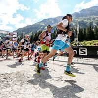
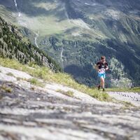
Running
Inicio
Verano Österreich
Tirol
Ötztal
Sölden
Excursiones
Running
Región
Alojamientos
El tiempo
Webcams
Consejos para el tiempo libre
Excursiones
Deporte
Fotos
Vídeos
Eventos
Ofertas
Proveedor de Deportes
Foro
Estación de esquí
Running
Sölden
Mapa
mostrar
ocultar
Filtro de circuitos
Tipo de excursión
(Todos)
Trailrunning (8)
Búsqueda de texto completo
Nivel
mín.
1 fácil
2 moderadamente
3 mediana dificultad
4 dificultad alta
5 muy difícil
6 extremo
máx.
1 fácil
2 moderadamente
3 mediana dificultad
4 dificultad alta
5 muy difícil
6 extremo
Técnica
mín.
1 fácil
2 moderadamente
3 mediana dificultad
4 dificultad alta
5 muy difícil
6 extremo
máx.
1 fácil
2 moderadamente
3 mediana dificultad
4 dificultad alta
5 muy difícil
6 extremo
Longitud (km)
Metros de altura
otros filtros
Buscar
Posponer
8 Excursiones.
ordenado por
Relevanz
Relevancia
längste Distanz
kürzeste Distanz
duración máxima
duración mínima
metros más verticales
menos metros verticales
alto estado
baja condición
alta tecnología
baja tecnología
Nombre A-Z
Nombre Z-A
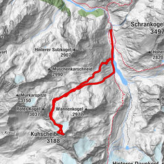
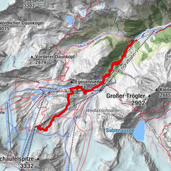
Sölden - Zwieselstein Tirol/Österreich
fácil
Trailrunning
6,28
km
00:46
h
148
hm
1.437 - 1.488
m
Técnica
Nivel
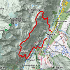
Archäologischer Rundwanderweg Obergurgl
medio
Trailrunning
11,25
km
03:08
h
782
hm
1.867 - 2.599
m
Técnica
Nivel
Gletscher Trailrun
Trailrunning
41,13
km
04:11
h
2.628
hm
1.766 - 2.980
m
GORE-TEX® TRANSALPINE-RUN 2016 4. Etappe
Trailrunning
26,23
km
02:46
h
1.872
hm
1.350 - 2.964
m
Stubai K8
Trailrunning
6,53
km
01:59
h
1.070
hm
1.759 - 2.872
m
STUBAI 8K (Mutterberg - Stubaier Gletscher)
Trailrunning
3,0
8,13
km
02:26
h
1.394
hm
1.744 - 3.138
m
GORE-TEX® TRANSALPINE-RUN 2016 5. Etappe
Trailrunning
32,49
km
03:22
h
1.359
hm
663 - 2.485
m
Testtour P105
Trailrunning
102,68
km
25:25
h
5.777
hm
1.341 - 3.057
m
Tous según tipos
Senderismo
Invierno
Bike
Alpino
Running
Motorsport
Otros
Trailrunning
Touren nach Regionen
Ötztal
13
Gipfeltouren in der Region
Nederkogel (3.163 m)
4
Gaislachkogel (3.056 m)
7
Schwarzkogel (3.016 m)
5
Wilde Rötespitze (2.966 m)
6
Grieskogel (2.909 m)
4
Wildes Mannle (3.019 m)
9
Rotkogel (2.894 m)
7
Vorderer Brunnenkogel (2.775 m)
7
Wildkarspitze (3.173 m)
5
Egesennieder (2.488 m)
9
Excursiones opcionales por los alrededores
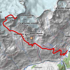
Hochtour Wildspitze, 3.768m
medio
Excursión de alta montaña
9,75
km |
1673
hm |
15:00
h
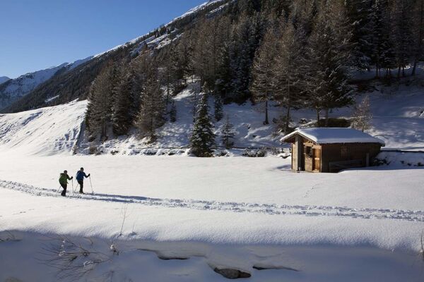
Roundway to suspension bridge - Sölden
fácil
Senderismo de invierno
4,39
km |
86
hm |
01:50
h
Kuhscheibe - Längenfeld/Gries
difícil
Esquí de travesía
10,57
km |
1017
hm |
06:00
h
Amberger Hut
medio
Senderismo
5,6
km |
495
hm |
02:15
h
Vecinos
Hochsölden
Obergurgl - Hochgurgl
Längenfeld - Huben - Gries
Pitztaler Gletscher - Bergbahnen Rifflsee
Vent
Regiones favoritas
Innsbruck
Lienz
Kufstein
Reutte
Imst
Tannheimer Tal
Neustift im Stubaital
Schwaz
Längenfeld - Huben - Gries
Ischgl
Telfs
Seefeld in Tirol
Matrei in Osttirol
Kals am Großglockner
Leutasch
Wörgl
Kaltenbach
Hall in Tirol
Umhausen im Ötztal
Jenbach
Sorteo
Produkt-Paket für die ganze Familie
Primavera XXL-Gewinnspiel
No se han encontrado entradas.
La búsqueda no está disponible actualmente.
Afine su búsqueda.
Resultados de la búsqueda local
(<= 25km)
Más resultados
(> 25km)
%count% Resultados de búsqueda
%name%
%type%
%elevation%
%population%
%lpButton%